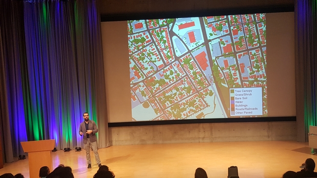
ESRI held its first ‘Imagery Education Summit' in Redlands California this week, and even though I came with high expectations, I was still pleasantly surprised with the caliber of the summit's presentations. It is very difficult to pick out a favorite among these talks; however, I can say that I particularly enjoyed the presentations by Jarlath O'Neil Dunn from the University of Vermont (pictured below), on ‘Success Stories and Progress' in image analysis and mapping, and by Jason Ur from Harvard University, regarding his work with ‘Drones and Archaeology Case Studies' in Iraq. The innovative approaches that they and others at the summit presented were truly inspiring!
One take-away from this event is that ESRI is making huge strides to incorporate more remote sensing processing options into ArcGIS Pro's ‘Image Analysis' toolbox. Speaking for myself, as both a remote sensing and GIS practitioner, I am excited about the prospect of being able to do more of my work within just one application environment, as opposed to doing my image stitching in Pix4D, image analysis in ENVI, and then finally my spatial analysis and mapping in ArcGIS. For the sake of efficiency, I look very forward to the day that I can do all of this in just one app.
For you drone enthusiasts out there, one neat new feature in the ArcGIS Pro Image Analysis tools is basic image stitching for producing color balanced orthomosaics and digital surface model outputs. This new function is not at the level of what Pix4D or Drone-to-Map can do yet, but for basic RGB image processing it may be good enough for many people's needs. Plus, it is a brand new tool that is bound to improve over time.
A couple more neat news items that were mentioned at the summit include:
- ESRI now offers a FREE ‘Schools Mapping Software Bundle', which includes both fully functional ArcGIS Pro and ArcGIS Online licenses for every K-12 school worldwide. http://www.esri.com/industries/education/software-bundle#.
- ESRI also now offers free ‘Massive Open Online Courses' (MOOCs), which among other things include approximately 30 courses on working with imagery alone, http://www.esri.com/mooc/imagery.
The future for spatial science has never looked brighter!
