Today marks the end of this year's California Naturalist Conference (http://calnat.ucanr.edu/2016conference/), where IGIS was once again honored to be a contributor at the fantastic gathering. Highlights from the event include:
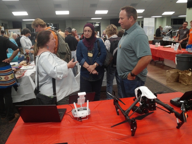
Working with Greg Ira of the California Naturalist Program, I led a Smartphone GPS and Mapping Skills workshop, which provided an introduction to free and inexpensive apps for collecting map data in the field and creating custom online maps out of the data that you collect. Meanwhile, our friend Ken-ichi Ueda led a similarly themed workshop that covered the outstanding mobile and online app that he developed, iNaturalist (http://www.inaturalist.org/); as a tool for furthering citizen science efforts. Citizen Science was a strong theme in this year's conference and we were pleased to see how much interest participants expressed in using spatial technologies to facilitate greater public engagement in science. Further reinforcing this theme, our UC Cooperative Extension Specialist colleague, Roger Baldwin, had a table at the conference displaying the Wild Pig Damage App that IGIS just built and published to the Google Play Store (https://play.google.com/store/apps/details?id=com.ucanr.wildpigdamage). This app was created through a collaborative effort between UC Cooperative Extension and IGIS to facilitate public collection of spatial records and pictures pertaining to wild pig damage on range, forest and agricultural lands throughout the state of California. On the final night of the conference our IGIS Academic Coordinator, Andy Lyons, presented a poster, which showcased the variety of activities and services that IGIS is currently engaged in, including mobile data collection, web mapping, geospatial analytics, training, and drone operations. Complementing Andy's poster session, I set up an adjacent table display with an assorted of IGIS's new drone equipment. This attracted a lot of attention to the scientific interests of IGIS and prompted many discussions of future applications for drone technology in relation to ecological monitoring and restoration.
I want to thank the leadership of UC ANR's California Naturalist Statewide Program (http://calnat.ucanr.edu/About_the_program/) for inviting IGIS to this year's conference, as well as UC ANR's Program Support Unit for going above and beyond to make it such a great event. The community of people who are involved with the California Naturalist Program are a truly inspiring group of people, and I look forward to our continued cooperation in the future.
