Introduction to Google Earth Engine, May 7, 2021
University of California, Division of Agriculture and Natural Resources
A Zoom Workshop
Friday, May 7th, 2021, from 1:00pm to 4:00pm
Click Here for Registration Waiting List
Requirements: Pre-register for an Earth Engine account at https://earthengine.google.com/signup/ using a gmail account. For best results, please install the Google Chrome web browser, or make sure Chrome is up to date.
Google Earth Engine - Earth Engine (EE) is a cloud/browser-based platform for planetary scale geospatial analysis that relies on Google's processing and storage capabilities to enable large analyses in very little time. It’s most relevant for people that are interested in using satellite and aerial imagery to study large areas, long time periods, or both. Earth Engine is home to hundreds of public remote sensing/geospatial datasets totaling more than thirty petabytes, and is continuously updated as images are captured. Check out the Data Catalog for more information. EE is an Application Programming Interface (API), meaning that we request data (raw or processed in some way) using a programming language. EE has both a JavaScript and Python API – this workshop uses the JavaScript API because the JavaScript Playground is more visually interactive and is easier to set up.
Audience:
- UC Cooperative Extension
- AIFS affiliates (including Davis, Berkeley, Cornell, U. Illinois, & USDA)
- UC students & faculty
- public and private professionals
When & Where: May 7th, 2021, from 1pm to 4:00pm
You will receive a Zoom link via email prior to the workshop.
Cost: This is a free workshop.
Register:
This event as reached capacity and now has a waiting list; to sign up for the waiting list please click here.
Registration priority will be given to UC ANR staff and academic affiliates.
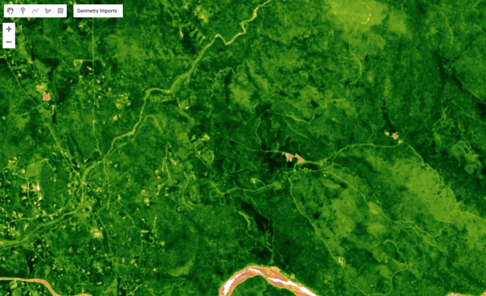
Goal: The goals of this workshop are to introduce you to the Earth Engine interface, import Sentinel (satellite) imagery, export a composite NDVI image, and analyze changes in NDVI over time.
Workshop Content: We will take advantage of the up-to-date and easy-to-access satellite imagery in Earth Engine to calculate and analyze changes in a vegetation index (Normalized Difference Vegetation Index, or NDVI) from recent Sentinel imagery at the Sierra Foothills Research and Extension Center. First, we’ll focus on the fundamentals that are needed to explore the Earth Engine API, including familiarity with JavaScript and common Earth Engine commands. Next, we’ll work through several basic tasks, ultimately building towards a simple analysis of NDVI over time and exporting a change image. The main goal of the workshop is to make the case that surmounting the initial hurdle of using JavaScript in EE is worth the payout in computational power and speed. Therefore, wherever you end up in this work flow is a success. Here are the main tasks you can look forward to completing:
- Run basic commands in JavaScript
- Search for and add Sentinel imagery an Earth Engine Script
- Print imagery datasets to the console to explore metadata
- Add images to the map and change display settings
- Construct a simple graph showing changes in NDVI over time within a rangeland ecosystem
- Calculate the change in NDVI and export the result


This course content is the result of a collaborative effort between UC ANR IGIS Statewide Program, the USDA-NIFA/NSF AI Institute for Next Generation Food Systems (AIFS), and the UC Berkeley Geospatial Innovation Facility (GIF).
For information regarding other upcoming IGIS workshops, please see IGIS training or contact Sean Hogan, 530-783-7843, sdhogan@ucanr.edu


