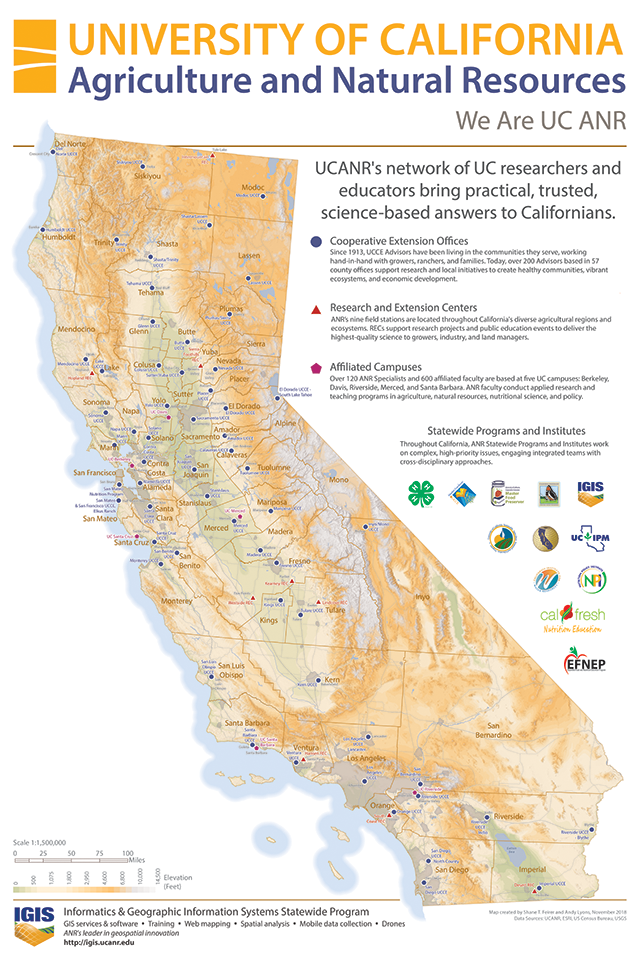
IGIS is pleased to release a new map of the ANR network. This poster-size map of the state includes 60 Cooperative Extension Offices, 9 RECS, and 6 affiliated campuses. The legend is accompanied by short descriptions of the main components of ANR, as well as logos of the Statewide Program and Institutes. As far as we know, this is the first attempt ever to map the entire ANR continuum.
Designing the map took several months. Our goal was to create a map that would serve both as a useful reference as well as communicate ANR's mission, structure, and programmatic breadth. Shane Feirer and Andy Lyons developed over 14 drafts in 2018 with input from the Strategic Communications Team and numerous County Directors. A prototype was displayed at the Statewide Conference in April 2018, where we received great feedback including the locations of a couple of satellite offices we didn't know about!
The final product has a classic look and feel to it, with numerous design elements from the ANR Branding toolkit. We created the map in ArcGIS Pro and designed it for bulk printing with a commercial 4-color offset printer. The later was anything but trivial, and we documented a number of tips and lessons learned in a new Tech Note.
Copies of the map have already been distributed to most County Directors and RECS, with a few more to go (if your office hasn't received one, please let us know!). We hope the map will educate visitors about ANR's geographic and programmatic breadth, as well as help orient new ANR employees to our amazing network and beautiful state.
A high-quality PDF copy of the map will be available in the ANR Repository in early 2019, making it easy to print additional copies at copy shops and office supply stores. The ANR network is alive and growing, so a map like this will never be finalized. We will continue to keep the PDF copy updated when we hear about changes to office locations and Statewide Programs. We love to get feedback, so please let us know what you think!
