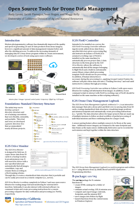
At the recent conference of the American Association of Geographers (AAG) in Washington DC, IGIS was recognized for its work in developing open source data management tools for drone data. The AAG is the largest association of geographers, GIS specialists, environmental scientists in the world, and its annual conference attracts over 8,500 people and over 6,900 presentations. IGIS researchers Andy Lyons, Jacob Flanagan, and Sean Hogan won second place in a poster competition sponsored by the AAG Remote Sensing Specialty Group and photogrammetry company Pix4D.

Data management involves protocols and file transfer utilities to help you organize data, assess quality, create backups, find and retrieve files, and reproduce workflows. Photogrammetry programs are brilliant at stitching photos into beautiful high resolution imagery, but they don't offer many tools for managing data before or after the processing. This is the gap IGIS is addressing.
IGIS has been working on data management tools for the past couple of years to help us manage the dozens of drone projects we conduct each year on behalf of UC researchers. In keeping with our public mission and research innovation focus, we use open source programming platforms such as Python and R and share our tools on GitHub so anyone can use them.
The poster presented at the AAG conference showcases 5 data management projects. The foundation of all our projects is a directory structure and file naming protocol that encompasses all the types of data in a drone project, including images, ground control points, GIS layers, documentation, intermediate files, and final outputs. Building upon this, the uavimg package for R creates offline HTML catalogs and maps of images, allow for quality control checks in the field and a master catalog to help an analyst find the right set of images for a project. The IGIS Drive Monitor, written in Python, is designed to run on a laptop in the field and automates the process even further by monitoring a USB drive and copying files into the right place automatically. The IGIS Pix4D Controller, also written in Python, runs on a server and automates the next step of the process, launching the Pix4D stitching software when a new set of images is detected, creating a new project, and initiating the stitching process. Finally, the IGIS Drone Data Management Logbook, still being developed, combines functionality of the previous utilities with additional visualization tools for quality control.
Our drone data management utilities are still under development, but they are available currently available for testing (see GitHub links in the poster). If you'd like to be a beta tester, please let us know!). Later this year, we plan on holding a webinar describing how to use these tools and invite feedback from users. Open source software is designed for collaboration, and our ultimate hope is to collaborate with other drone users and programmers facing similar needs. In the meantime, it's great to be recognized by leading experts in the field.
Contributor - Director, Statewide IGIS Program, Professor and Cooperative Extension Specialist
Attached Files: