Have you ever wanted to work with climate change data? Last week I took a workshop from the UC Berkeley Geospatial Innovation Facility (GIF) titled "Working with Climate Data (link). This workshop showed how to work with climate data hosted by the GIF in their Climate App (Cal-Adapt) and other climate data hosted as NetCDF datasets. Through this workshop we learned how to use jupyter notebooks and the python language to query and analyze these types of data. The workshop also highlighted the use of NetCDF data within ArcGIS Pro and its new multidimensional charting tools.
I recommend this training and other trainings held at the GIF. I look forward to applying these new tools in my work with IGIS.
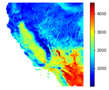
The image below is the Growing Degree Days calculation for 2013 with a 10 degree C base, that I was able to develop with techniques used at this workshop.
