Pix4D Mapper for Drone Imagery Demo/Presentation, October 4, 2024
University of California, Division of Agriculture and Natural Resources
A Zoom Presentation
Friday, October 4th, 2024, from 1:00pm to 2:00pm
Click Here to for Registration
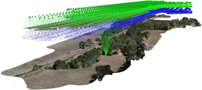
Presentation: Following a brief introduction, a demonstration of the Pix4D Mapper software application will walk viewers through all of the necessary steps to rigorously process multispectral drone imagery into GIS ready orthomosaic and digital surface model layers.
Pix4D Mapper: Photogrammetric image processing applications are used to generate color-balanced and spatially accurate orthomosaic and elevation models for mapping interests. Among these apps, Pix4D Mapper is one of the premier and most commonly used software applications currently available.
Participants will not be expected to follow the presentation as a hands-on exercise, however if there is interest in using this application at a later time, UC ANR affiliates can request access to Pix4D Mapper through the IGIS website by Clicking Here, and non-ANR affiliates can receive a limited 15-day trial version of Pix4D Mapper by Clicking Here.

Audience: This presentation is intended for UC Cooperative Extension affiliates, including UC students and public and private resource professionals, with an interest in using drones for mapping and research. No previous experience is needed.
When & Where: October 4th, 2024, from 1pm to 2:00pm
You will receive a Zoom link via email prior to the presentation.
Cost: This is a free presentation.
Register: Click Here

This course content is the result of a collaborative effort between UC ANR IGIS Statewide Program, the USDA-NIFA/NSF AI Institute for Next Generation Food Systems (AIFS), and the UC Berkeley Geospatial Innovation Facility (GIF).
For information regarding other upcoming IGIS workshops, please see IGIS training or contact Sean Hogan at sdhogan@ucanr.edu


